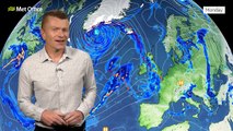
00:00Hello, good morning and welcome to your latest Met Office forecast.
00:04And for most of us it will be a dry day ahead, a cold frosty start in places thanks to
00:10high pressure sat to the north of the UK,
00:12but low pressure sits to the southwest.
00:15And we're in a bit of a slow moving weather pattern at the moment, so this weather front isn't going
00:19to go anywhere very quickly.
00:21We're expecting some very heavy rain across parts of Devon and Cornwall in particular for Met Office yellow rain warning
00:27in force for much of the day.
00:28So there could be some localised disruption as we move through the day ahead.
00:33So looking at the rainfall totals for today, widely across Devon and Cornwall we could see 40 millimetres or so.
00:40Locally in the south 60 millimetres and perhaps as much as 80 to 100 across Dartmoor in particular.
00:46This is likely to lead to some flooding disruption.
00:49So it is worth staying up to date to our warnings as we go through the day ahead,
00:53as we are expecting some local flooding over the course of the day.
00:57So this rain remains in place through the day.
01:00It could also move into southern parts of Wales at times, as well as getting close to parts of Northern
01:05Ireland.
01:06But after a frosty start for most of us, it will be a dry day with some bright or sunny
01:10spells and generally light winds.
01:12Though the wind's coming in from the east, so it will pull in some showers from the North Sea across
01:17eastern areas.
01:18But most places should stay dry and the rain also perhaps stretching along some southern coasts of England as well.
01:24Despite the sunny spells, it will be another cold feeling day.
01:27Temperatures may just be a touch higher overall today compared to yesterday, but still feeling rather chilly with that easterly
01:34breeze.
01:35Top temperatures towards the southwest around 12 Celsius.
01:38But with the cloud and the rain around here, it will still be on the cold side.
01:43And with clearing skies, we'll see temperatures once more across Scotland into northern England, the Midlands, eastern England, fall below
01:50freezing.
01:51Though some showers still feeding in from the North Sea could lead to a few icy stretches along the east
01:56coast.
01:57In the west, the band of heavy rain starts to ease.
02:00It does move a little bit further north and eastwards into parts of Northern Ireland and Wales, but generally turning
02:06much lighter.
02:07And overnight, we can see a widespread frost across northern and eastern areas.
02:11Towns and cities below freezing in the countryside, a good minus five or so.
02:16So some thick frost to start the day, but temperatures across the west on Monday, already around five or six
02:21Celsius under the cloud.
02:23And patchy rain, which just generally lingers for much of the day.
02:26But overall, it will be a drier picture in the west and southwest compared to today for Monday.
02:32But we will see some showery outbreaks of rain.
02:35Plenty of sunny spells once more across central, northern and eastern parts of the UK.
02:42Though still some showers close to the east coast, one or two of these on the heavy side.
02:47Remaining in the cold air with light winds across central and eastern areas, seven or eight degrees.
02:51Again in the west, where the winds are coming in from the south, highs around nine to 12 Celsius.
02:58In the week ahead, it does remain a complex picture.
03:01We're likely to see the cold air remain close to the UK.
03:04A lot of cloud around at times.
03:06The risk of further weather systems, which will be slow moving, moving in from the Atlantic.
03:10So southern and southwestern parts of England and Wales may continue to see the risk of some flooding in places.
03:17But in between some sunnier spells at nighttime, frosts continue and temperatures by day generally a little below average for
03:25the time of year.
03:26So for the day ahead today, there is some heavy rain around across southwest England.
03:31Stay tuned to the forecast and see you again soon.